Saturday, November 4, 2017

Nippenicket November


Consumed by planning my abortive attempt at the Wampanoag Canoe Passage, I actually only kayaked a few times this season.  Today I woke to a bright, cool morning and determined to go to my favorite pond for the first time this year.  My only plan was to enjoy whatever fall color remained.  

Bridgewater's Nippenicket pond is a mile long with a crinkly shoreline and a few small islands.  Waterfront houses both modest and palatial dot the southern shoreline, displaying the variety of ways people enjoy the water.  I have habitually wandered these shallows in my kayak and shamelessly gazed into people's backyards.  Today, though, I went another way, along the straighter eastern shore and soon reached the northern half, which snugs into the edge of the fabled Hockomock Swamp.  I hadn't been this way in over a year, and had forgotten how pretty these wilder parts are.


 I would have LOVED to have a treehouse like this overhanging the water.  Heck, I'd still love it.


 At this point, the road comes close enough to the pond to leave no room for a house lot.
I like to imagine neighborhood kids take advantage of this "unusable" waterfront.


 Little fall color remains.  Here is, I think, highbush blueberry (above) and black oak (below).


I think this is the last house but one before the Swamp.  Quite an estate; a bit out of my price range.
I'm betting nice views from the giant windows and lower and upper decks.

 Birch glows in the sun.


A kitchen stool, in good condition, upright, in the middle of nowhere.  (This photo
beside entry for "middle of nowhere" in the dictionary.)  Evidence for the recent
operation nearby of an Infinite Improbability Drive?  Probably not.  But still...


Nearing the northern end.

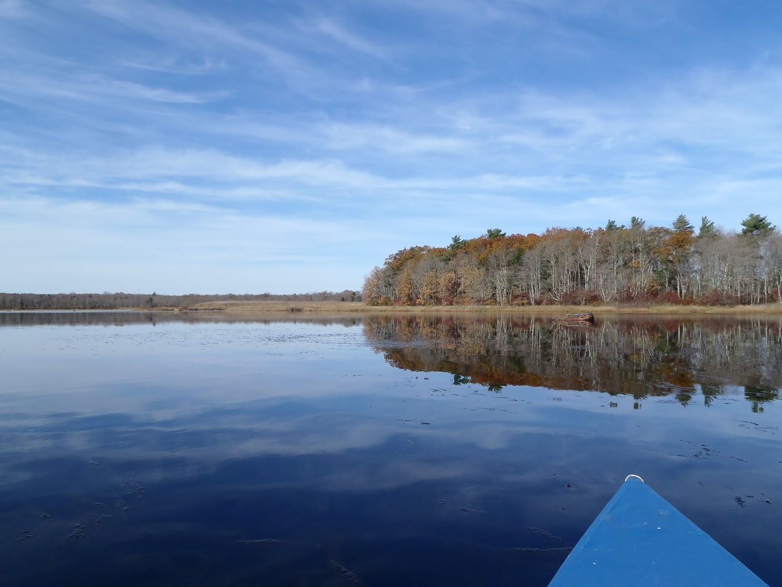
Ponds generally get shallower and smaller over time.  This was likely
once an island in the larger pond.  Now it is an island in the marsh.  


 It's hard to see here, but a track through the marsh continuing into a path ashore
tells of regular visitors to this island.

I wish I'd realized where I was when I took the videos below.  I was near the northernmost part of the pond--a place usually choked with water plants and nearly impassable, but accessible at the high water level after all the rain we've had.  The pond is there the source of a stream that flows into the Swamp, and eventually becomes a major tributary of the Taunton River.  In years past I despaired of ever reaching that stream, but it would have been much easier today.  I think I see a return trip this season.


Headed home.


Friday, November 3, 2017

Blue Hills Reservation: Natural Gem of the Boston Area (7) Indian Pass Path and Crags Foot Path

Preamble  On the way to my intended hike late in September, I stopped at Chickatawbut Overlook, where a patch of low ground is cut over at intervals to maintain a meadow that gives a view of Boston.  I like meadows, and wasted little time in getting down into it.

Chickatawbut Overlook, and the view from the wall at the top of the meadow on a hazy day.

The meadow, and a steeplebush (Spirea tomentosa) I collected seeds from: I want to grow some.

Back of the overlook is a fairly civilized and well-traveled walk up Chickatawbut Hill.


Views from the top of Chickatawbut Hill.


The main event   The northeastern end of Blue Hills Reservation stretches beyond the Blue Hill Reservoir and Chickatawbut Road into Quincy.  I parked in the small lot just west of the reservoir, and crossed the street and headed into the woods on Brook Path.


I planned to take a connecting path from Brook Path to Fox Hill Path
and thence to Indian Camp Path--until I saw how steep it was.
Going farther brought me to another connector without the need to scramble.


Higher and drier ground made for more open woodland.

Silverrod (Solidago bicolor) growing amongst grasses and chestnut oak (Quercus prinus) seedlings.


A little fall color in huckleberry (Gaylussacia) and a lowbush blueberry (Vaccinium pallidum).


Panicled hawkweed (Hieracium paniculatum).

A rare sign marks this as a green dot trail--a forest track.


I think these distinctive little dingles or hollows--perhaps six fee
deep at the deep end--are natural, but I have no idea how they form.

Perhaps the largest chestnut oak I've seen.

Yellow birch (Betula allegheniensis).

Sassafras.

The only water I saw on the walk.

I've seen a lot of fallen trees, but none with a root spread so big!  It still had some dead leaves,
but the stones unearthed by its fall were clean, so the tree probably fell months ago.

Red maple (Acer rubrum.)


The returning connector from Crags Foot Path joins a gas pipeline route for a distance.

The sunny pipeline route was perfumed by sweetfern (Comptonia peregrine)--a relative of bayberry.

Goldenrod and aster on the pipeline.

Yellow birch.

Spicebush (Lindera benzoin) is a shrub I associate with rich woods.

Rattlesnake plantain (Goodyera pubescens), with its variegated leaves,
is an easy-to-recognize native orchid.


Gently up, then steeply down Fox Hill.
The slope looks a little less forbidding than it did from the bottom, at the start of the walk.

This brings to an end my forays into parts of Blue Hills Reservation new to me.  But I have already been back to several of them--for some things bear repeating.