
I had three days free in mid-July, and an itch to go voyaging. Taking Surprise from Fall River to Prudence Island is a modest trip that would fit. Fortunately, I had gradually been getting ready in the vague expectation of an opportunity like this.

I've taken Surprise to Prudence twice before--both times in April. After footsore miles on my 2014 trip, I packed my bicycle aboard for 2017. (I know no other 15-foot boat that can carry a bicycle in its cabin. Heck, precious few that HAVE a cabin.) On both trips I was fascinated by the many different styles of homes on the island; I've long been interested in how we arrange our living spaces to take advantage of the outdoors. But on this trip I wanted to explore the wild side: the vast majority of the island is protected land, and there are lots of trails.
Sunday is a busy day at the boat ramp. Though I arrived at 1pm, I didn't get off the dock until 2:15. Winds were very light but favorable, so I made my down Mt. Hope Bay easily but at a very slow walk.

Once away from the ramp, the Braga Bridge is the first major landmark. Once under it, I am out of the Taunton River and in Mt. Hope Bay. Surprise's mast is off-center. Her completely open 8-foot cabin stores my bike to port, and to starboard the covers that close the slot top in bad weather. (Behind those are my air mattress.) Under the foredeck are bedding, clothing, freshwater, toilet, and miscl. (A larger space under the aft deck holds food, kitchen, spare sail, and varied personal gear.)

Behind me, the old brick factory marks the location of the ramp.

Serious racing.

The Braga Bridge passed, we go southwest with a gentle breeze behind us at about 2 knots.
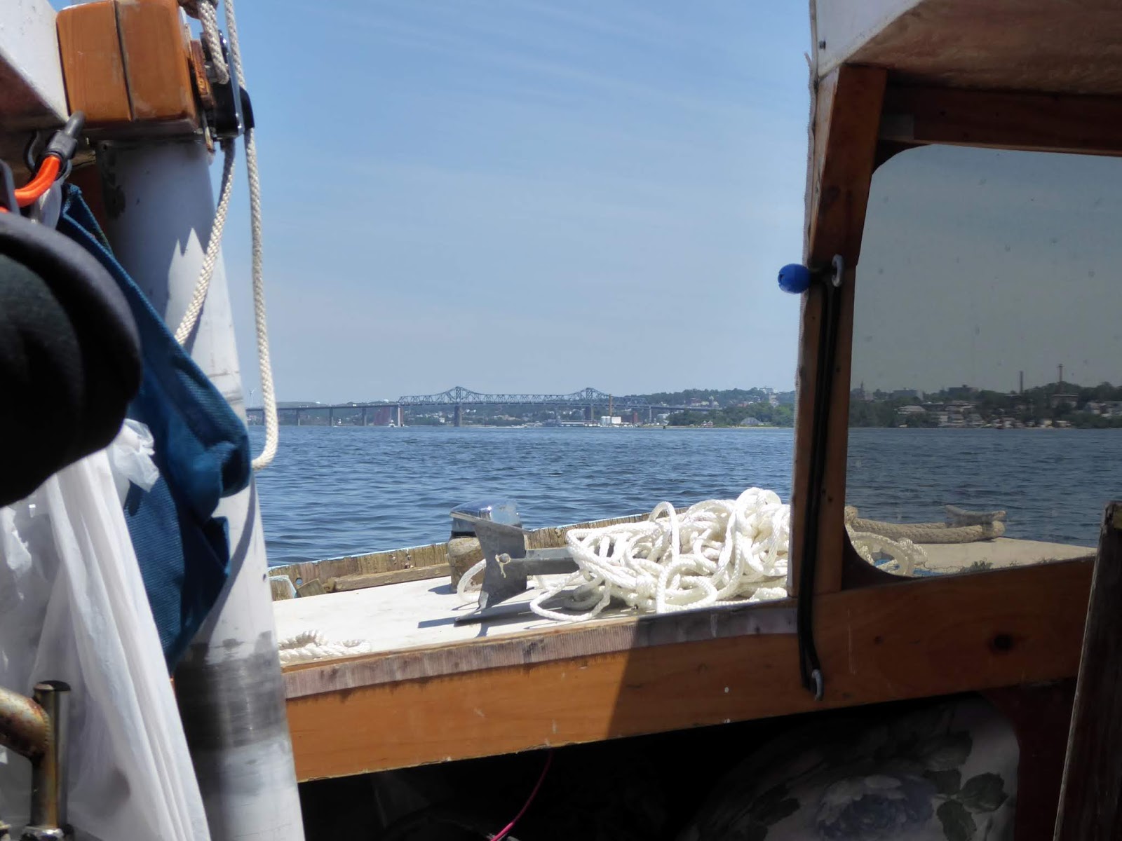
Across the southern end of Mt Hope Bay, the Mt. Hope Bridge joins Aquidneck Island to Bristol, RI. Hog Island (a destination of earlier adventures) lies at the mouth Bristol Harbor. After passing under the bridge and hooking around Hog, Potter Cove, Prudence Island is only a couple of miles away.

"Downtown" Prudence Island in the distance has a general store/Post Office, and the ferry landing.


Going ashore in Potter Cove went more smoothly than two years ago--not that that's saying much. Rather than trying to anchor near enough to shore to go back and forth on foot, this time I towed my kayak, Pink Flamingo. Once the bike was ashore, I poled the boat into deeper water and used the kayak to get to shore. (Being able to anchor off was doubly lucky since miserable midge season was in full swing in the salt marsh.)
After topping up my leaky tires, it was time to ride up the road a bit.

I'd love to know the history of these two old houses.


 The north end of the island is entirely protected by the NBNERR,
The Rossis raise several breeds of beef cattle, heritage breed hogs, and dairy goats.


Gates stopped me from going farther than the farm. I didn't learn until the next day that the remaining lands at the north end were conservation lands, and welcomed hikers.

My zoom lens brought close an egret in the salt pond by the cove.


Sunset. The lights on the Mt. Hope Bridge came on--presumably colored for Independence Day.
The lights became more prominent as the sky grew darker.


Bright sunlight flooding the cabin and my inability to keep the midges off my face had me up at 6:30. Oatmeal and strong coffee followed, as I surveyed my anchorage. Herring gulls sculled overhead. One flew over my head with something--presumably a clam--and upon reaching the beach flew sharply upward before dropping it from a height. I hadn't seen this myself and was struck by how intelligent this behavior seemed.


Potter Cove and the spit that encloses it. My anchorage is off the photo on the lower left. The spit was my first exploration; stopping where the vegetation is low near the bottom and top.
By 8:30am I was loading the kayak for a day away. I meant first to explore the spit that enclosed the cove by kayak--something I'd never done. I began near the tip of the peninsula, where the vegetation was low. After greeting the ospreys that nested on a small cement building (from a respectful distance), I began to walk across the high marsh, looking at some of the plants. A willet took offense at my presence, and tried to blend into the grasses. Other willets took flight, displaying their distinctive wing bands. Willets are my new favorite birds.

Pink Flamingo ready to take me around the woods in the middle of the spit to another area of marsh. Strapped behind the cockpit is my backpack, shoes, helmet and tire pump.

An osprey pair. I don't know if eggs or chicks were present.


Saltwort or glasswort, (or samphire or pickle plant) Salicornia sp., is a succulent that survives in salty soil by accumulating salt in its tissues. It's supposed to make very good pickles.


Sea lavender (Limonium carolinianum) has low leaves but grows a branching plume that bursts into color in late summer. (Bottom: in flower last year in Nauset Marsh.) It's not related to true lavender.


A willet wading.

Willet in flight.


Willet wishing I were elsewhere.


Herring gull in repose.

Further up the spit, a smaller spit encloses a mini-cove.

Sea lavender Limonium carolinianum again.

After a couple of stops along the spit, the kayak carried me
back to the "mainland" and my waiting bicycle.


An egret mom on an outing with two of her offspring. They were unwilling to let me get at all close.


The many holes scattered in salt marsh peat hold marsh crabs. They're generally nocturnal, but I caught this one just before he vanished sideways into his hole. Marsh crabs have become more abundant, and are blamed for the decline in high marsh. Why they're more abundant is unclear.

Surprise rides to her anchor twenty yards off shore. Her high sides catch the breeze,
and she constantly swings from side to side.


Salt marsh rush Juncus gerardii is an important component of the high marsh.


Grayer color marks salt grass (Distichlis spicata) off from the
salt meadow cordgrass (Spartina patens) that generally rules the high marsh.

Swinging off on my bike, I rode the six miles to the NBNER Reserve, only stopping to find (with disappointment) that the island historical society was closed on Mondays. I explored rooms that ran from child-friendly exhibits of taxidermy animals to scholarly articles like one about the possibility of salt marsh survival in a rapidly warming world. (Doubtful, since sediment deposition appears too slow to compensate for rising sea levels.) A worker at the center encouraged me to explore the many trails on the island, and gave me the latest version of a trail map.
Finding I was on T-wharf Road, I went looking for the T-wharf I visited once with my boys on our first Big Adventure aboard the brand-new Beatrice Ann, back in 2005. But first I was distracted by a sign that told of pine barrens along the way.
Sandy soil sometimes left by receding glaciers holds water and nutrients so poorly that few plants grow successfully. Those few plant species characterize pine barrens (locally also called "deserts"). Pitch pine (Pinus rigida) is the major tree, while the shrub layer has a highbush blueberry, sweetfern, the low ground-cover bearberry, and others. A grass or two fill out the sparse vegetation. One reason pitch pine rules the barrens is that barrens burn. Pitch pine is resistant to fire--even requiring fire for its cones to open and disperse seeds. Without fires at intervals of a decade or so, the barrens might become oak woodland. Pine barrens are a rare habitat, and the Reserve carries out managed burns on a schedule to help maintain this rare ecosystem on the island.

The main visitors' center today, and on our visit in 2005, when the boys were 9 and 4.


Pine barren and its plants. Charred wood and bark from previous fires is everywhere visible.


"Crown fires" fed by long-accumulated fuel kill just about everything, but more regular ground fires need not be fatal to pitch pines. Grasses are almost "designed" to burn, since only their leaves and flowers emerge above ground, while their perennial parts are out of the way underground.


Asters.

Pitch pines have recently shed their pollen from tiny, light brown, finger-like male cones.
These will soon fall, leaving the larger female cones and their seeds behind.

The barrens go on for a long way.


T-wharf, along with this whole end of the island, was once part of a naval station here.

On our earlier visit, the boys and I beached the Beatrice Ann beside the T-wharf,
and then got a ride to the Reserve center on the tailgate of a pickup truck.

I know it's more complicated than this, but I was struck by the longevity of Styrofoam.

Farnham Farm, not far from the Reserve center,
is today maintained by volunteers as an educational resource.


I had never seen a ginkgo this large. Now I know what a mature ginkgo looks like.


The Farnham Farm gardens include a large blueberry orchard, and these grape trellises.


A horse chestnut tree with character.

The short Crow's Nest Trail was named, I suppose, because a hill near the end looks out over the water. Tiny Dyer Island (formerly military but now conservation land) is about a half-mile away. Below is a forest of masts at marinas on Aquidneck Island.

The trail map's description attracted me to the Boundary Wall Trail, but the instructions for finding it were vague. But the new Deer Chase Run Trail was easy to find, and could be combined with the BWT to make a big loop. A Coke and a cold bottle of water from the general store fortified me, and I went in search of Sunset Hill Avenue. Deer Chase Run Trail, goes westward almost to the other side of the island over a mile away, then connects to half-mile Sunset Trail which runs south and overlooks the water, and finally Division Wall Trail cuts straight back across the island, and the shorter Diamond Trail brought me back near my starting point. The trails are generally well-marked, and mowed (against ticks) where there is grass.

Near its end, the Deer Chase passes through a bit of pine barren. Reindeer moss
(Cladonia) is a lichen characteristic of dry, open ground like that in pine barrens.


Cladonia close up. Millipedes (below) are herbivores and so harmless to us,
but this one--about four inches long--gave me pause.


The Sunset Trail is only a half-mile long, but it has lovely peekaboo views of the water.


I couldn't quite make out the inscription on the stone, and left it in its place.


The beginning of the Boundary Wall Trail.

I got interested in the wall, which goes on, almost ruler-straight, across the island. (The trail crosses it several times through gaps.) Most walls in southern New England mark the boundaries of property, or agricultural fields or pastures--and make a place to get rid of the many rocks that make plowing fields hereabouts nearly impossible. But this wall is much longer. The construction of the wall varies according to the kinds of rocks it was built with. Today it is very low in some places, but as much as five feet high in others.


The next stone was plainer. I returned it to its place, also.


Called the Division Wall, it's a major feature of the man-made landscape here. It runs straight and across the entire island for over a mile, which argues for a big, prolonged communal effort. Only when I got to my desktop computer did I learn the history. It turns out to be even older than I suspected: Division Wall was built in the late 1600s marking the boundary between the northern land of Roger Williams, founder of Rhode Island, and the southern owned by Governor John Winthrop of the Massachusetts Bay Colony. (Williams was something of a heretic in the eyes of the Mass Bay folks--believing in freedom of worship, and respecting Indians, among other odd things.)


Someone has an interesting hobby! All the "kindness stones" were left where found,
but I will have to post the photos.
but I will have to post the photos.


Confused by trail crossings, I went back and forth a bit before finding my way back to the road. (My step counter awarded me a "High Tops Badge" for walking over 20,000 steps this day.)

Out of the woods, and ready to go back aboard for dinner and rest about 7pm.

Before going aboard for the evening, I needed to pick up the anchor and paddle it farther from shore: I wanted to avoid any more visits from marsh midges. Iwas tired and unsure how to proceed and it was a laborious process--and not entirely successful. I also fought off midges as I got the bike aboard to simplify departure in the morning. It turned out there was enough room in the 8ft-long cabin for my bike and my bed.

Looking at the morning, coffee in hand.
I looked forward to photographing morning birds, but didn't see much.
I had thought perhaps to go ashore for a brief exploration of the conservation land I'd turned back from the first day. But I had a tide to catch, and after ruminating over my oatmeal, I decided to head home. The Reserve worker I'd met the day before had said the northern areas were old farmland, and rather choked with alien invasives, anyway. The sail was rigged and the anchor off the ground about 8:30. A wind shift meant that winds were fair going home just as they had been sailing the opposite track two days before. (That seems a lot rarer than the wind being foul in both directions!)

Wash hung out to dry is a clue that this is a liveaboard.

Lifelines along the sides, chafing gear on the shrouds:
this boat is rigged for long distances in open water. The dingy signals that crew are probably aboard.

I wish I'd thought to photograph her stern--with her name I could have looked her up online.

Saying goodbye to the ospreys.


Leaving Potter Cove.

Halfway across the East Passage.

My definition of a BIG boat is one that has its windows in the hull.


Castle Rock nearby, Bristol Harbor directly north of Hog Island.

Coming around the north end of Hog Island.


After passing beneath the Mt. Hope Bridge, I am back in Mt. Hope Bay.
From north of Aquidneck Island, you can see both bridges that join it to the mainland.

Ahead is the Braga Bridge, not far from the boat ramp and home.

The Brayton Point Power Station was the last coal-burning power plant in Massachusetts.
I used to watch coal ships unload mountains of coal. The plant shut down in early June,
and the cooling towers were just demolished.
I made one of my few creditable landings back on the dock in Fall River at about 2pm. A weathered guy ambled down the dock with a boy in tow, and hailed me with a Portuguese accent. He had thought to help me dock, but saw, he said, that I had everything under control. He explained something to the boy, then translated for me that I was a real waterman, like the men of his country, and that I had built that boat myself. I thanked him, trying not to show as much pride as I felt.
No comments:
Post a Comment