Driving Massachusetts route 138 eventually brings you to the old Raynham Dog Track, which since
passage of a law banning dog racing has become a sprawling industrial park. Park in front of the old dog
track building and walk southwest among the giant trucks and construction vehicles just as if you
belonged there. Right after passing over a stream bridged by pavement edged with jersey barriers, you
will take a right and find yourself on a rolling, potholed dirt track that runs ruler-straight beneath pines, oaks,
red maples and white cedars: the great Hockomock Swamp.
 |
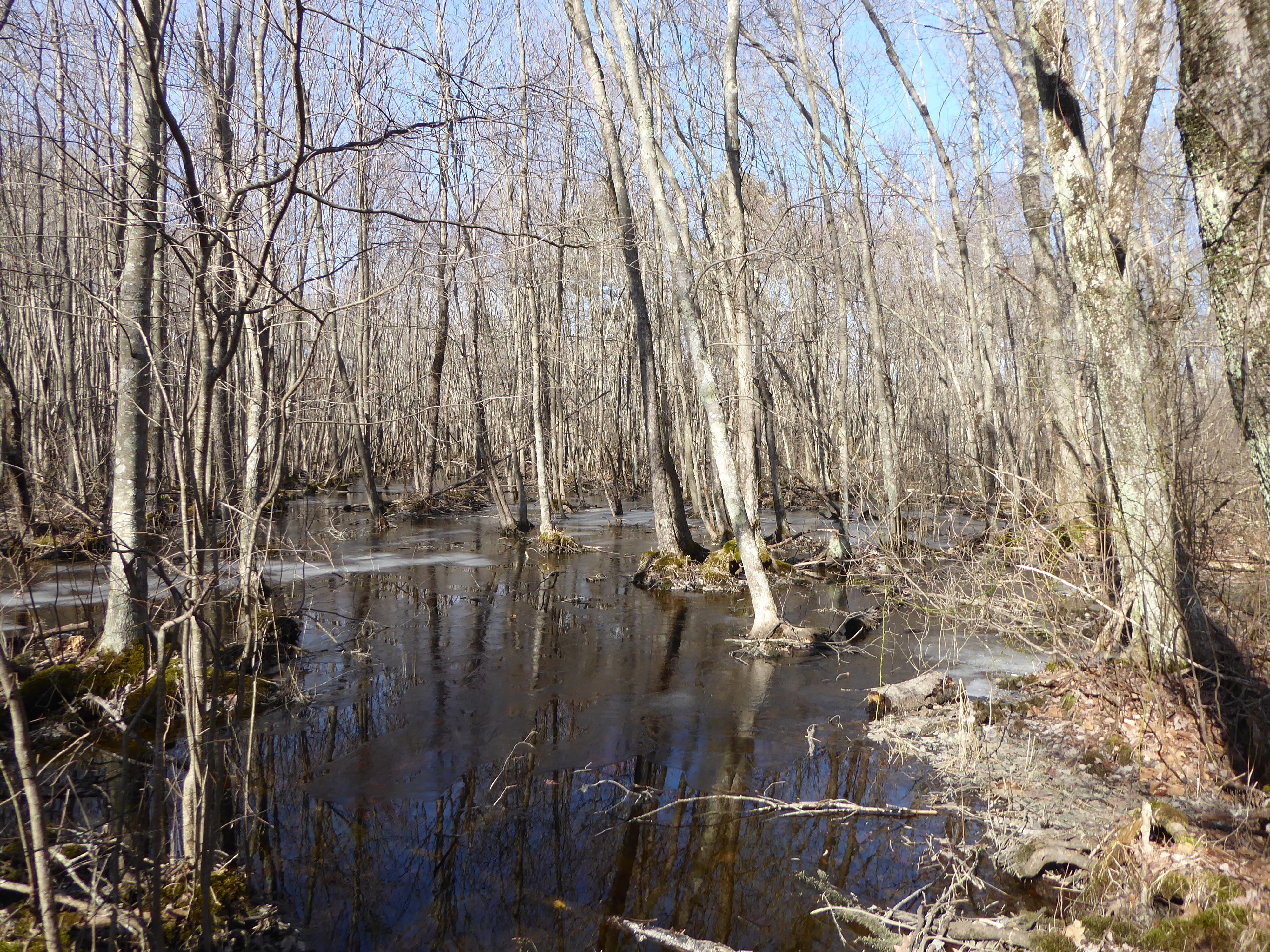
| This pond beside the railway embankment is still frozen, but not all are. |


Hockomock is the largest freshwater wetland in Massachusetts, and though it has been intruded on and
built into over the centuries, a substantial heart still remains. If you are a casual walker, navigation within
Hockomock is simple: the old railway embankment you have stepped onto runs straight through the
swamp almost north-south, intersecting a powerline right-of-way that trends northwest-southeast. My
experience has been that these two lines pretty much define where you can go without ending your days
tangled in briars or stuck in trackless, knee-deep ooze.
A week or so ago it suddenly occurred to me--after not thinking about the swamp for years--that I could
walk at will in Hockomock if the ground and water were frozen. We had had a warm spell, but I hoped that there
might--just might--be enough frozen bits out there to enable me to thread my way to the intriguing “South
Island,” which name Google Earth gives to a quarter-mile oval of what appears to be higher ground. With
winter nearly gone, it was at least worth a try.

The first bridge. (Early photos are overexposed: I had been shooting birds in treetops that morning.)
A half-mile up the railroad embankment, wet ground on the left gives way to standing water: connected ponds or very slow-moving streams. These shut off any possible path to South Island. But as I pause before returning south to find another way, my eye catches something strange. A few steps nearer, a little bridge of split saplings joined by nailed crosspieces presents itself. Extending both my trekking poles to help my balance, I get across the first bit of water easily. From there, you choose your path by avoiding deeper water that looks almost narrow enough to leap across in favor of broader wet spots with serendipitously-placed stumps, fallen branches and hummocks. After another little distance, a second bridge appears. This one is narrower and less stable and appears to be in the middle of the water, but my confidence is growing: someone took considerable trouble to haul materials and tools out here, and had a clear idea of the best path.
I am reminded of a computer game I played decades ago, called Myst: the player is dropped into a world without explanation or any clear goal, but exploration brings unexpected paths to light, and the accumulation of subtle clues gradually unearths bits of the backstory. Bridges go somewhere. Let’s see where this “somewhere” is, and why someone wanted to come back to it.
 |
| The water all around is in neither ponds nor streams, exactly--it flows just fast enough that it doesn't freeze too readily. |


In a moment or two I am on dry ground in an open space; not a clearing since there are still trees, but an area mostly free of undergrowth. And there on a stump is a green wine jug--empty, except for whatever rain and detritus have gotten in the open top. Is this South Island? I didn’t think I’d come far enough off the railroad embankment. There was virtually no sign of recent human presence other than the jug. Probing the edges of the space, I found it bordered by open water on several sides, but briars prevented my checking more thoroughly. Just when I thought to return, I came upon a clear, straight path. It was not heavily trodden, but there was enough packed ground with no obstructions to make clear that it went Somewhere. And it led not back, but onward, toward water.
 |
| The third bridge, and the view from it. |

A minute’s easy walk and I was at another bridge, broader and stronger than the first two. And this time the path continued plain on the other side along a straight sort of causeway. Old bricks were incongruous reminders that the swamp had a history, and had not always been so trackless.


The walking was easier and straighter over near-level path on dry ground. As the bridges had spoken of the efforts of several people over several days, the path must get enough use and maintenance to be so clear. Who had made these? I went on for some distance before it occurred to me to check the time: I wouldn’t want to navigate way across the water in failing light. I would turn back at 3pm, giving me only a short time for further exploration. While stopped, I got my tablet out of my backpack and fired up Google Earth to see where in the swamp I was. I wasn’t entirely hopeful: for some reason the gps position my tablet provided to Google could be off by quite a lot for no apparent reason. And so it was: the dot marking my position was east of the railway embankment, rather than west. Even as I watched, the blue dot shifted randomly. But there was still my phone. When I first began walking, I started a tracking app that began laying down my track on whatever trail map the app had found. Lo and behold, the tracking app showed background information that Google Earth lacked. I was at this moment on South Island, and the entirety of South Island lay within the borders of the Easton Rod and Gun Club. The trails I was walking were probably used for hunting. Despite not being hunting season, I was very glad I was wearing my bright red down jacket! And the mystery was, rather prosaically, solved.
In Myst there were discoveries to be made, puzzles to be solved, and maybe an innocent to be rescued. If Hockomock Swamp isn't so obviously exciting, it is no invention, but very real.
 |
| A straight path. |

 |
| South Island includes ground that is at least three feet above the level of the swamp. |
 |
| My jacket, hung 6 feet above the ground, show the white pine and oak near the center of the image to be at least 60 feet tall. |
I had been a little apprehensive about finding the way out, but it turned out that the way was clearer and seemingly more direct going out than coming in. I was soon beyond the wine jug, and then out of the Rod and Gun Club altogether.
I was a little disappointed that so promising a part of Hockomock was actually private land, but glad I had gotten to explore a place new to me.

Back on the railway embankment.

 |
| This might solve an earlier mystery--evidence of heavy machinery in this Area of Critical Environmental Concern: they might have been installing these. (Is anyone else annoyed by the redundancy in the name?) |


No comments:
Post a Comment